United States Maps Home > United States Map Collection > Northeastern Minnesota Map
Printable Map of Northeastern Minnesota
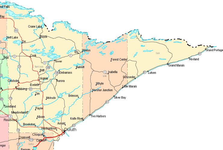
On top you have a classic depiction brandishing the geography of this region with a basic collection of features.
You are allowed to print this web page and use it for a variety of purposes. Giving credit to this webpage would be considerate and well thought of.
In case you require aid locating a map, a specific map, or require a good personalized creation, please do not hesitate to get in touch with us.
Buy good tailor-made maps from us. Our custom maps provide a refreshing collection of map elements, such as: main arteries, map projection, coordinate grid, campsites, conservation areas, springs, falls, or plains, etc. Map types range from topographic to navigational, digital to hardcopy, world to planning regions.
Good maps are succinct, up to date, and not misleading. Detail-Oriented map design by YellowMaps.
To buy actual maps that get delivered in the mail to your home, for instance wall maps, maps for kids, or hiking maps, please visit our map store It contains more than 100,000 maps.
Ever wondered why there are so many different maps around? Well, to cover the whole of North America at let's say 1:24,000 scale, you will need more than 100,000 maps. This would be millions of maps if you want to cover the whole earth at that scale. It's a big place!
Back to United States map collection